India is one of the countries most populated and diversity, and the best part is Indian Himalayas. Delighted Journey organizes tailor-made itineraries throughout India, including the Himalayan regions of which we are particularly expert, and participates in major cultural events with organized trips.
You can contact us for upcoming trips led by our guides and among the tailor-made trips we have included a set of well-tried and tested routes that allow you to intelligently explore the main regions. Do not consider what is shown on the site as an exhaustive list: depending on everyone’s interests, there are infinite other possibilities and possible combinations that we can recommend.
To evaluate the different opportunities that India offers us, and get an idea of the paths that can inspire you, you can start by consulting the part dedicated to tailor-made trips to India. And you can examine the group trips carried out by Delighted Journey that are found in the history: there are a large number of them and they also touch on the cultural aspects of the country.


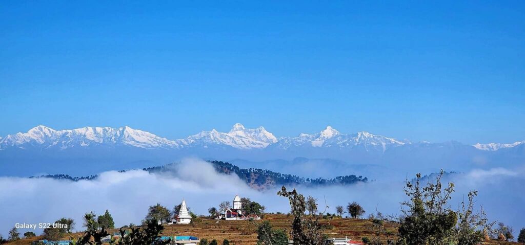
The Himalayas are a fantastic space from every point of view for those who love to explore and learn about the world. India’s northern border surrounds all of this vast territory, except for the tracts occupied by the state of Nepal, which separates the western and eastern Indian Himalayan regions and, further east, from Bhutan.
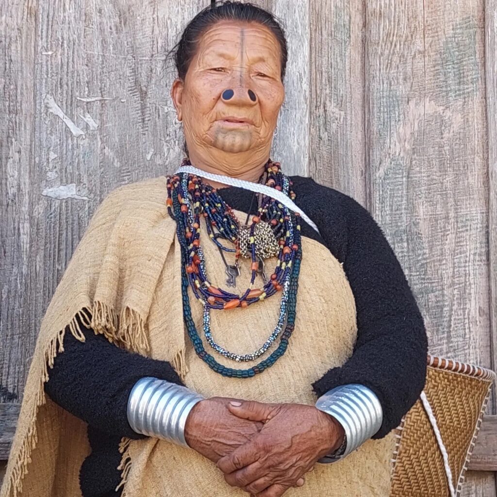
In India we thus encounter all the possible environmental characteristics of the most imposing mountain system in the world, from the desert areas of the trans-Himalayan part of the north-west to the impenetrable Assamese rainforests of the east. The cultural panorama is equally varied, hundreds of different ethnic groups have found refuge among these valleys, who have been able to preserve customs and traditions thanks also to the remoteness of their territories.
This variety makes broad and varied exploratory choices possible, depending on both personal interests and the seasons.
The pages in this section deal separately with the western and eastern regions of the Indian Himalayas and, in a specific section, several suggestions are collected for optimal tailor-made itineraries. Delighted Journey also regularly organizes accompanied trips to these territories which are included in outgoing trips. For a general evaluation of the great variety of opportunities offered by these magical territories, it may also be useful to consult the history of group travel in these magical regions, in fact, a good part of these could be replicated or be the starting point for planning new adventures.

The Indian Himalayan chain from west to east is about 2000 kilometers long and its width from north to south varies quite a lot, being much wider in the west and progressively narrowing towards the east. From a geological point of view it is a vast territory but conventionally identified in a simple way: the mountainous regions south of the two great Indus and Brahmaputra rivers, whose sources are near Mount Kailash in Tibet, are considered “Himalaya“. They draw its borders by flowing the first, the Indus, from Kailash westwards through Ladakh and up to Nanga Parbat (8125 m), where it bypasses this colossus to proceed from here southwards arriving to water the plains of Pakistan. The Brahmaputra always flows from the Kailash region eastwards, following the long Tibetan valleys north of the Himalayas up to the last great eastern pillar, the Namcha Barwa (7782 m), whose base the river surrounds with terrifying waterfalls and rapids, emerging through very deep gorges southward into the Indian plains of Assam and Bangladesh.
The range is not a watershed, in addition to these two colossal rivers there are many others that begin their course in the valleys north of the grandiose peaks and then flow south into the Gangetic plain of India, of these, the largest are the Sutlej, which rises from the sacred lakes at the foot of Mount Kailash, and the Arun, which collects the waters of Everest and Makalu.


There is no “census” of the Himalayan mountains, there are so many peaks that a good part have not yet been climbed and many mountains do not even have a name. The most marked corrugations are found largely in the central-eastern region which collects almost all the “8000”, where the width of the chain is smaller and the impact of the geological thrust of the Indian subcontinent towards the Tibetan plateau is vented in a smaller space. But apart from the famous “8000”, which attract both for their objective magnificence and for their heights, there is practically no end to the mountains and valleys of unimaginable beauty that make up what is undoubtedly the most fascinating chain in the world.


The western Himalayan region of India starts from the Gangetic plains and reaches the far north up to the borders of the remote Aksai Chin, the very high plateau that constitutes the western edge of Tibet, and the offshoots of the Karakorum chain, where the temporary border line with Pakistan it has points of comparison above 6000 meters above sea level and whose largest glacier, the Siachen, pours its waters into the Nubra valley north of Leh in Ladakh.
Starting from the west, we come across the Kashmir region, then the trans-Himalayan desert areas with a Tibetan ethnic majority of Zanskar, Ladakh, Rupshu and Spiti and, located between Kashmir to the west, Himachal to the south and Spiti to the east, the Lahaul valleys, with a Buddhist majority but with mixed ethnic groups. In the southern arboreal part to the south-east of Kashmir we find Himachal and therefore Uttarakhand, where, in the mythical region of Garwal, the sacred areas par excellence for Hindus are located with the four yatras, the sources of purification par excellence, and beyond we still reach the Nepalese border.
In these areas with such different characteristics, a large part of the possible Himalayan climates and natural environments are found, divided into the two main areas: trans-Himalayan desert and southern arboreal, with all the possible intermediate variations. Each of these regions has different characteristics from a climatic, cultural, environmental and accessibility point of view, and the type of services available also changes from area to area.
Let’s see in summary what are the main useful aspects to keep in mind.
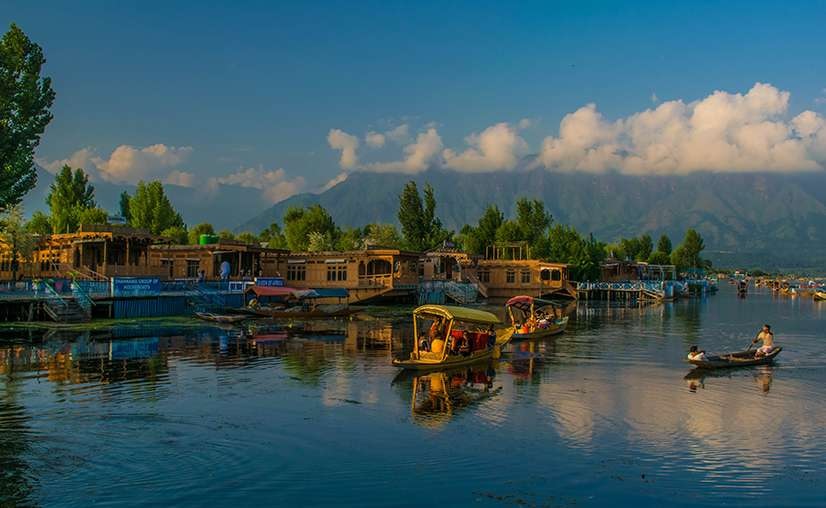
The Kashmir region is the westernmost part of the Indian Himalayas, which for many years has been little frequented by visitors due to the problems caused by Islamic extremists, before this long dark period the Srinagar valley was very prosperous, also known for its exquisite artisanal production, and tourism on the houseboats on its lakes was one of the classic images of a trip to India. After the interruption due to the Covid period, travelers have started to return, particularly to Srinagar, but also to the surrounding areas, among the very beautiful mountains of this region where the valleys resemble some of our alpine areas, with coniferous forests and glacial mountains, of which the Kolohoi, about 5800 meters high, is the most daring.
An important reason for visiting Kashmir has always been the summer pilgrimage of Hindu devotees which takes place annually following the path between the Pahalgam and Sonamarg valleys that leads to the Amarnath cave, to pay homage to an ice lingam. From this region there are also paths that lead in a few days’ walk to the Suru valley, at the gates of Ladakh and Zanskar, while to the south east towards Lahaul there is the interesting region of Kishtwar, from where trekking routes are possible in little explored areas that lead up to Zanskar and among these the most accessible is perhaps the Umasi pass path. Before attempting trekking in these more remote mountain areas inhabited by Muslim populations, it is always advisable to check the safety level of the areas you intend to visit, given that fortunately local conditions are generally safe today.
Most travelers passing through Kashmir today arrive in Srinagar by land from Amritsar or by flight, to continue eastwards to Ladakh following the road that leads to Sonamarg and, over the Zoji La pass (3528 m), to Dras and in Kargil, on the Suru river, from where you can also continue towards Zanskar. This pass is rightly famous due to the astonishing change in the natural environment: from the west you go up through the coniferous forests, to the east you descend into the high altitude desert typical of the trans-Himalayan regions. You also pass through one of the coldest points in the world: in Dras temperatures have exceeded -50°C in winter!

The trans-Himalayan region which includes, from west to east, Zanskar, Ladakh, Rupshu and, further south, Lahaul and Spiti, is administratively divided between the Indian regions of Jammu and Kashmir and Himachal Pradesh, with the part of Ladakh and of Zanskar which have recently received important recognition of local autonomy. It is a vast territory immersed in the heart of the Himalayas bordered by Kashmir to the west, Tibet to the east, the Karakorum chain and the Aksai Chin plateau to the north and Himachal to the south. A small part of the monsoon wave only touches the westernmost and southernmost valleys, where the dense humid current manages to tranship beyond the great barrier of the mountains. It is therefore a territory that progressively becomes desert as you enter the more internal parts, but there is no shortage of water because the valleys are always crossed by rivers and on the peaks there are snowfields and glaciers. The average height of the valleys is very high, and only in Lahaul is it possible to drop below 3000 metres: Padum in Zanskar is at 3200, Leh in Ladakh at 3500 and Kaza in Spiti at 3800, while the Rupshu plateau never drops below 4200.
The climate is very cold in the winter with frequent peaks of -30°C. and occasional drops in the mercury to even lower values. In winter many areas become practically unreachable because the roads close due to snow falling on the passes but Leh, the main center of Ladakh, is always accessible by plane, and once you arrive in the great Indus valley you can always move around because within Ladakh there is little snowfall and vehicles can move, thus making it possible to participate in some very interesting winter festivals. Even within Lahaul and Spiti in winter vehicles can move and the tunnel that has been opened under the Rothang pass has made access to Lahaul much easier. Zanskar is always blocked by snow, and it is not easy to reach these areas in winter: the Chadar trek that leads to Zanskar along the frozen river has become almost a legend! However, the road already opened from the Indus River, located further north, arriving at Padum, the main center of this remote region, which could perhaps make winter access by motorized vehicles possible. The summer period, on the other hand, presents an excellent climate, dry and sufficiently warm, but spring, with the flowering of the oases, and the beginning of autumn, with the intense colors and the purest skies, are also exceptional moments. Most visitors choose the period from June to September, preferring the months of July and August.
The populations that inhabit this part of the Himalayas escaped the devastating wrath of the Chinese invasion that plundered Tibet, and were able to preserve their traditional habits and customs without interference.
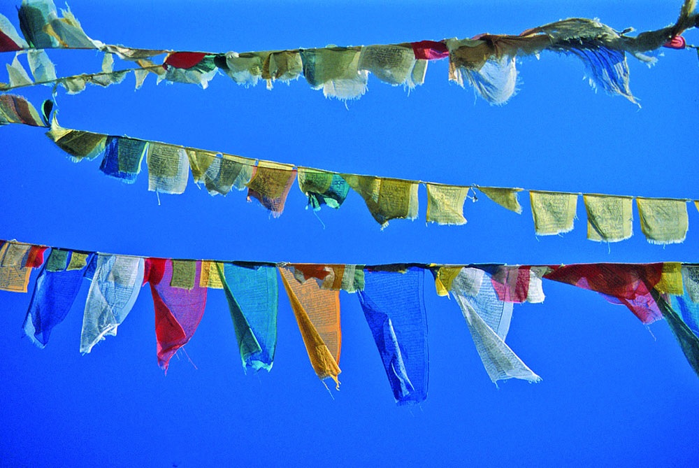
Delighted Journey offers various itineraries throughout the region, and, usually in the summer period, also organizes trips with a companion. To explore these regions you can choose routes that embrace the Himalayan arc from Shimla to Leh, through Kinnaur, Spiti, Lahaul, Rupshu and Ladakh, or easier programs, which for example involve going directly to Ladakh by flying to Leh, where you can take advantage of our services using Leh as a starting base. For a well-calibrated set of possibilities it is useful to consult the Tailor-made Routes, and it may also be useful to examine the group programs found in the history, they are almost all replicable. It is advisable, if the dates are compatible, to participate in one of the festivals that take place in the monasteries, in a few days you will be able to touch first-hand the heart of life in these valleys, which is permeated with smiling spirituality. For those who want to live an experience as close as possible to the people of Tibetan lineage and their way of life, in contact with the nature of the high altitude deserts, and who likes to try their hand at trekking, you can take in consideration of walking routes which open up a world of fantastic possibilities.
For more specific information on the different characteristics of these trans-Himalayan regions, we recommend connecting to the pages of the site that deal with them individually.


Himachal is predominantly made up of an arboreal Himalayan environment, the Indian administrative region of ‘Himachal Pradesh‘ also includes Lahaul and Spiti, which however are culturally and due to their environmental typology part of the trans-Himalayan region.
In southern Himachal there are many sites that are worth a visit, starting in the west from the town of Dharamsala, resting on the slopes of the first large mountains, where the exile Tibetan community lives, many Tibetan exiles have settled here, creating a large community, so much so that the locality is also called “Dhasa”, which stands for the ‘Lhasa’ of India. Here in MacLeodganj the 14th Dalai Lama has his residence, there are the offices of the Tibetan government in exile with a large set of centers of profound cultural interest, from the Norbulingka institute to the Tibetan Library to the Medical and Astrological Center, to many monasteries and study centers of Tibetan culture, with also schools for traditional arts. Many of these institutions hold courses open to foreign visitors, generally in English. In the surrounding area there are many important places for the Tibetan tradition, from the sacred lake of Tso Pema to the center of the Bön school of Menri and so on.
To the east of Dharamsala, the best-known areas are Kulu and Manali, destinations very popular today with Indian tourists looking for refreshment in the summer period, with valleys which, to the north, become deeper, always rich in forests. North of Manali you reach the Rothang pass which leads to the Lahaul valleys, where a tunnel has now been opened which allows access to the Lahaul even in the cold seasons, and from here eastwards following the spectacular granite valley of the Chandra river and crossing the Kunzum pass (4551 m) takes you to Spiti and, instead going north, overcoming three very high passes, you arrive in Rupshu and then in Ladakh, following the southern access route to the Leh valley.
Shimla, the administrative center of the region, is further east, founded by the English to be a climatically comfortable location in the summer period, it preserves the memory of the Raj period and can still be reached by a narrow-gauge colonial-era train. From here you access the upper valley of the Sutlej river, which flows wildly from the Kailash region in Tibet, and going up it you arrive in the territories of Kinnaur, ethnically very interesting, of mixed Hindu and Buddhist culture, with notable sites such as the Bhimakali temple , the town of Kalpa, famous for the view of Mount Kinnaur-Kailash, and the interesting valley leading to Chitkul. Continuing you reach the edge of Tibet and the confluence with the Spiti river, thus accessing the region of the same name, in summer in upper Kinnaur this road is subject to a possible inconvenience, the interruption, usually temporary, due to landslides.
The extraordinary barrier of mountains that delimits Himachal from the Lahaul and Spiti regions is crossed by few paths, which lend themselves to particularly adventurous walking routes, the best known is through the Pin Parbati chain, which starting from near Manali reaches the Kungri valley in Spiti, touching places where it is possible to spot the snow leopard! But most of this vast region of spectacular and impervious mountains is almost unreachable and almost uninhabited. In the more southern parts, for example in the mountains of Dharamsala, or even in the surroundings of Manali, beautiful walks or not overly demanding treks of just a few days are possible.
Good quality hotels are found in the main centers of Himachal. In the more remote valleys, however, there are only modest but fairly clean hotels, and in Kinnaur in many places there are only rather rudimentary accommodation facilities. The roads are easily passable and connect almost all places of interest. However, it should be kept in mind that the passes may be closed in winter.

Uttarakhand is located between Himachal and Nepal, the main center is the city of Dehra Dun, where some important members of the Tibetan community in exile find refuge: the Sakya school, with also the residence of their Abbot, and the main center of the Nyingmapa school, Mindroling. On the slopes of the mountains above the city is Mussoorie, originally a place of refuge for the English, now a destination for Indian tourism and home to many private schools.
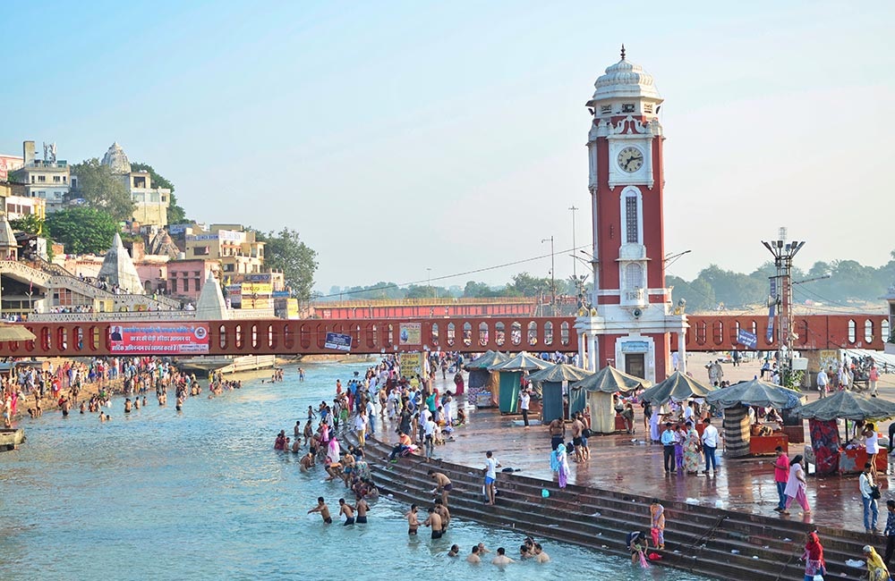
The most important sites in the entire southern belt of this region, from Dehra Dun to the Corbett national park to Nainital lake and the hill town of Almora, are the holy city of Haridwar and nearby Rishikesh. At this point, where the Ganges flows into the plains, there are a large number of Ashrams, where yoga and meditation courses are also held, some of which are open to visitors. These towns are pilgrimage destinations and Haridwar is one of the four cities part of the great Kumbhamela. Western visitors usually prefer Rishikesh, smaller and quieter, which over time has also become one of the classic meeting places for travellers. Even in the surrounding mountains there are many points of interest for lovers of the Hindu world, including the sanctuary of Sri Devi, from which you can enjoy a fantastic view of the entire region.
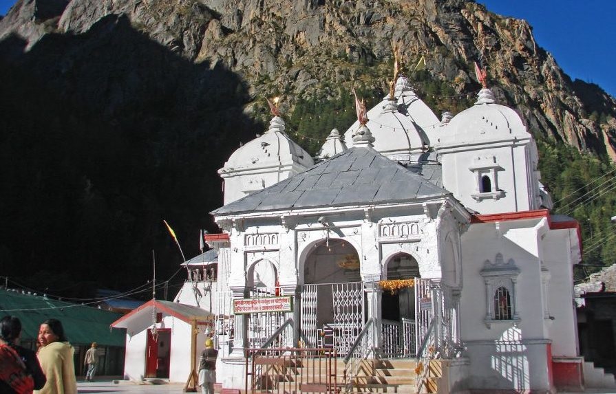
If you enter the northernmost valleys of Uttarakhand you enter the Garwal region, where the four sacred yatras are located, of supreme sacredness for Hindus, the paths of supreme purification that lead to the sources of the Ganges: Yamunotri, Gangotri, Kedarnath and Badrinath. Gangotri and Badrinath can be reached by car, but the access roads usually open no earlier than the end of May and close towards the end of September. If you want to visit the other sites or reach beyond Gangotri to Gaumukh, the mouth of the glacier where the Ganges (Bhagirathi River) flows, or go from here to Tapovan at the foot of Mount Shivling, you need to cover part of it on foot. In this you are usually in good company: many Indians follow these pilgrimages, and you also meet many Sadhus and Swamis, plus some rich Indian lady carried on their shoulders on the “Dolly” palanquin.
In addition to its cultural interest, the region itself is splendid from a natural point of view, with mountains that reach the peak of Nanda Devi at 7816 meters and many mountains that have entered the legend of mountaineering. For enthusiasts there are numerous trekking routes and epic high altitude crossings are also possible, including the stupendous connection between the Gangotri and Bradinath glaciers, or more accessible experiences such as the exploration of the “Valley of Flowers National Park” in the Nanda Devi National Park.
Here too, as in Himachal, there are good quality hotels in the main centers and more modest accommodation in the more inland areas. The roads are often winding but all passable and connect almost all the places of interest, it should just be kept in mind that in the winter months and until spring many of the higher reaches remain closed.


The eastern Himalayas of India have two distinct areas, separated from Bhutan: the regions of Sikkim and, to the east, Arunachal Pradesh.
Sikkim is a vast amphitheater of valleys wedged between Nepal and Bhutan: to the west it reaches the slopes of Kanchendzonga, the grandiose mountain it shares with Nepal, to the north and for much of the eastern edge it borders Tibet from which it is separated from the Chola chain, on which a rather easy pass opens up used as a historic southern access route to Gyantse and Lhasa, while in the south-eastern part it borders Bhutan.
Arunachal Pradesh, on the other hand, extends east of Bhutan reaching as far as Myanmar (Burma) and borders Tibet to the north, the grandiose Himalayan mountains that follow the northern edge slowly decrease here, progressively immersing themselves in the forests, where tribal areas predominate.
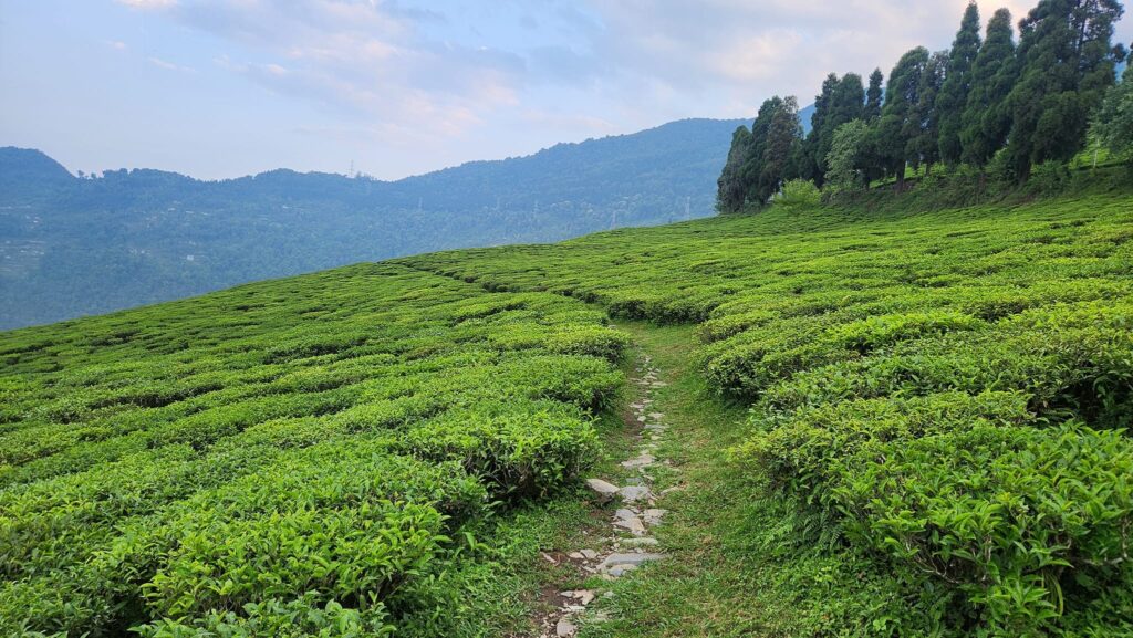
Both areas are subject to the monsoon flow which is very intense from late May to August, which becomes powerful in the easternmost regions near Myanmar where intense rains often begin in April and last until September. In all these regions we find lush, green valleys with incredible biodiversity: along a single mountain side of Sikkim we can find from orchid flowers to rhododendron forests.
In the Himalayas, but at not exaggerated altitudes
The eastern Himalayan regions of India can be visited without necessarily having to deal with significant high altitude problems, for example in Sikkim the highest point reached by a trip is often Gangtok, the capital, a town perched on the mountains which extends from 1500 meters up to around 2000 meters at the highest point, where the Royal Palace and the Gompa of Enchey. But for lovers of thin air, Sikkim also offers excellent trekking opportunities on the slopes of Kanchedzonga.
In Arunachal the highest areas are in the north west, where we find the remote Tawang Gompa which is located at around 2900 m; to get up there the highest point of the road is the Se pass at 4050 m.
The cultural landscape is extremely varied with a very different human geography in the two regions, you encounter dozens of different ethnic groups with distinct languages and customs. The folkloric aspect is therefore of exceptional interest and in Arunachal there are also many tribal realities. From a historical point of view, the oldest parts are found in Sikkim in the Yuksom region, the ancient capital of the kingdom, and in Arunachal in the Monpa valleys.
From the point of view of services, Sikkim is well structured, with almost European-level accommodation in most places, while in Arunachal tourism is in its infancy and in many areas the structures are rather spartan, suitable for travellers, not tourists.
India is one of the countries most populated and diversity, and the best part is Indian Himalayas. Delighted Journey organizes tailor-made itineraries throughout India, including the Himalayan regions of which we are particularly expert, and participates in major cultural events with organized trips.
You can contact us for upcoming trips led by our guides and among the tailor-made trips we have included a set of well-tried and tested routes that allow you to intelligently explore the main regions. Do not consider what is shown on the site as an exhaustive list: depending on everyone’s interests, there are infinite other possibilities and possible combinations that we can recommend.
To evaluate the different opportunities that India offers us, and get an idea of the paths that can inspire you, you can start by consulting the part dedicated to tailor-made trips to India. And you can examine the group trips carried out by Delighted Journey that are found in the history: there are a large number of them and they also touch on the cultural aspects of the country.
The Himalayas are a fantastic space from every point of view for those who love to explore and learn about the world. India’s northern border surrounds all of this vast territory, except for the tracts occupied by the state of Nepal, which separates the western and eastern Indian Himalayan regions and, further east, from Bhutan.
In India we thus encounter all the possible environmental characteristics of the most imposing mountain system in the world, from the desert areas of the trans-Himalayan part of the north-west to the impenetrable Assamese rainforests of the east. The cultural panorama is equally varied, hundreds of different ethnic groups have found refuge among these valleys, who have been able to preserve customs and traditions thanks also to the remoteness of their territories.
This variety makes broad and varied exploratory choices possible, depending on both personal interests and the seasons.
The pages in this section deal separately with the western and eastern regions of the Indian Himalayas and, in a specific section, several suggestions are collected for optimal tailor-made itineraries. Delighted Journey also regularly organizes accompanied trips to these territories which are included in outgoing trips. For a general evaluation of the great variety of opportunities offered by these magical territories, it may also be useful to consult the history of group travel in these magical regions, in fact, a good part of these could be replicated or be the starting point for planning new adventures.
The Indian Himalayan chain from west to east is about 2000 kilometers long and its width from north to south varies quite a lot, being much wider in the west and progressively narrowing towards the east. From a geological point of view it is a vast territory but conventionally identified in a simple way: the mountainous regions south of the two great Indus and Brahmaputra rivers, whose sources are near Mount Kailash in Tibet, are considered “Himalaya“. They draw its borders by flowing the first, the Indus, from Kailash westwards through Ladakh and up to Nanga Parbat (8125 m), where it bypasses this colossus to proceed from here southwards arriving to water the plains of Pakistan. The Brahmaputra always flows from the Kailash region eastwards, following the long Tibetan valleys north of the Himalayas up to the last great eastern pillar, the Namcha Barwa (7782 m), whose base the river surrounds with terrifying waterfalls and rapids, emerging through very deep gorges southward into the Indian plains of Assam and Bangladesh.
The range is not a watershed, in addition to these two colossal rivers there are many others that begin their course in the valleys north of the grandiose peaks and then flow south into the Gangetic plain of India, of these, the largest are the Sutlej, which rises from the sacred lakes at the foot of Mount Kailash, and the Arun, which collects the waters of Everest and Makalu.
There is no “census” of the Himalayan mountains, there are so many peaks that a good part have not yet been climbed and many mountains do not even have a name. The most marked corrugations are found largely in the central-eastern region which collects almost all the “8000”, where the width of the chain is smaller and the impact of the geological thrust of the Indian subcontinent towards the Tibetan plateau is vented in a smaller space. But apart from the famous “8000”, which attract both for their objective magnificence and for their heights, there is practically no end to the mountains and valleys of unimaginable beauty that make up what is undoubtedly the most fascinating chain in the world.
The western Himalayan region of India starts from the Gangetic plains and reaches the far north up to the borders of the remote Aksai Chin, the very high plateau that constitutes the western edge of Tibet, and the offshoots of the Karakorum chain, where the temporary border line with Pakistan it has points of comparison above 6000 meters above sea level and whose largest glacier, the Siachen, pours its waters into the Nubra valley north of Leh in Ladakh.
Starting from the west, we come across the Kashmir region, then the trans-Himalayan desert areas with a Tibetan ethnic majority of Zanskar, Ladakh, Rupshu and Spiti and, located between Kashmir to the west, Himachal to the south and Spiti to the east, the Lahaul valleys, with a Buddhist majority but with mixed ethnic groups. In the southern arboreal part to the south-east of Kashmir we find Himachal and therefore Uttarakhand, where, in the mythical region of Garwal, the sacred areas par excellence for Hindus are located with the four yatras, the sources of purification par excellence, and beyond we still reach the Nepalese border.
In these areas with such different characteristics, a large part of the possible Himalayan climates and natural environments are found, divided into the two main areas: trans-Himalayan desert and southern arboreal, with all the possible intermediate variations. Each of these regions has different characteristics from a climatic, cultural, environmental and accessibility point of view, and the type of services available also changes from area to area.
Let’s see in summary what are the main useful aspects to keep in mind.
The Kashmir region is the westernmost part of the Indian Himalayas, which for many years has been little frequented by visitors due to the problems caused by Islamic extremists, before this long dark period the Srinagar valley was very prosperous, also known for its exquisite artisanal production, and tourism on the houseboats on its lakes was one of the classic images of a trip to India. After the interruption due to the Covid period, travelers have started to return, particularly to Srinagar, but also to the surrounding areas, among the very beautiful mountains of this region where the valleys resemble some of our alpine areas, with coniferous forests and glacial mountains, of which the Kolohoi, about 5800 meters high, is the most daring.
An important reason for visiting Kashmir has always been the summer pilgrimage of Hindu devotees which takes place annually following the path between the Pahalgam and Sonamarg valleys that leads to the Amarnath cave, to pay homage to an ice lingam. From this region there are also paths that lead in a few days’ walk to the Suru valley, at the gates of Ladakh and Zanskar, while to the south east towards Lahaul there is the interesting region of Kishtwar, from where trekking routes are possible in little explored areas that lead up to Zanskar and among these the most accessible is perhaps the Umasi pass path. Before attempting trekking in these more remote mountain areas inhabited by Muslim populations, it is always advisable to check the safety level of the areas you intend to visit, given that fortunately local conditions are generally safe today.
Most travelers passing through Kashmir today arrive in Srinagar by land from Amritsar or by flight, to continue eastwards to Ladakh following the road that leads to Sonamarg and, over the Zoji La pass (3528 m), to Dras and in Kargil, on the Suru river, from where you can also continue towards Zanskar. This pass is rightly famous due to the astonishing change in the natural environment: from the west you go up through the coniferous forests, to the east you descend into the high altitude desert typical of the trans-Himalayan regions. You also pass through one of the coldest points in the world: in Dras temperatures have exceeded -50°C in winter!
The trans-Himalayan region which includes, from west to east, Zanskar, Ladakh, Rupshu and, further south, Lahaul and Spiti, is administratively divided between the Indian regions of Jammu and Kashmir and Himachal Pradesh, with the part of Ladakh and of Zanskar which have recently received important recognition of local autonomy. It is a vast territory immersed in the heart of the Himalayas bordered by Kashmir to the west, Tibet to the east, the Karakorum chain and the Aksai Chin plateau to the north and Himachal to the south. A small part of the monsoon wave only touches the westernmost and southernmost valleys, where the dense humid current manages to tranship beyond the great barrier of the mountains. It is therefore a territory that progressively becomes desert as you enter the more internal parts, but there is no shortage of water because the valleys are always crossed by rivers and on the peaks there are snowfields and glaciers. The average height of the valleys is very high, and only in Lahaul is it possible to drop below 3000 metres: Padum in Zanskar is at 3200, Leh in Ladakh at 3500 and Kaza in Spiti at 3800, while the Rupshu plateau never drops below 4200.
The climate is very cold in the winter with frequent peaks of -30°C. and occasional drops in the mercury to even lower values. In winter many areas become practically unreachable because the roads close due to snow falling on the passes but Leh, the main center of Ladakh, is always accessible by plane, and once you arrive in the great Indus valley you can always move around because within Ladakh there is little snowfall and vehicles can move, thus making it possible to participate in some very interesting winter festivals. Even within Lahaul and Spiti in winter vehicles can move and the tunnel that has been opened under the Rothang pass has made access to Lahaul much easier. Zanskar is always blocked by snow, and it is not easy to reach these areas in winter: the Chadar trek that leads to Zanskar along the frozen river has become almost a legend! However, the road already opened from the Indus River, located further north, arriving at Padum, the main center of this remote region, which could perhaps make winter access by motorized vehicles possible. The summer period, on the other hand, presents an excellent climate, dry and sufficiently warm, but spring, with the flowering of the oases, and the beginning of autumn, with the intense colors and the purest skies, are also exceptional moments. Most visitors choose the period from June to September, preferring the months of July and August.
The populations that inhabit this part of the Himalayas escaped the devastating wrath of the Chinese invasion that plundered Tibet, and were able to preserve their traditional habits and customs without interference.
Delighted Journey offers various itineraries throughout the region, and, usually in the summer period, also organizes trips with a companion. To explore these regions you can choose routes that embrace the Himalayan arc from Shimla to Leh, through Kinnaur, Spiti, Lahaul, Rupshu and Ladakh, or easier programs, which for example involve going directly to Ladakh by flying to Leh, where you can take advantage of our services using Leh as a starting base. For a well-calibrated set of possibilities it is useful to consult the Tailor-made Routes, and it may also be useful to examine the group programs found in the history, they are almost all replicable. It is advisable, if the dates are compatible, to participate in one of the festivals that take place in the monasteries, in a few days you will be able to touch first-hand the heart of life in these valleys, which is permeated with smiling spirituality. For those who want to live an experience as close as possible to the people of Tibetan lineage and their way of life, in contact with the nature of the high altitude deserts, and who likes to try their hand at trekking, you can take in consideration of walking routes which open up a world of fantastic possibilities.
For more specific information on the different characteristics of these trans-Himalayan regions, we recommend connecting to the pages of the site that deal with them individually.
Himachal is predominantly made up of an arboreal Himalayan environment, the Indian administrative region of ‘Himachal Pradesh‘ also includes Lahaul and Spiti, which however are culturally and due to their environmental typology part of the trans-Himalayan region.
In southern Himachal there are many sites that are worth a visit, starting in the west from the town of Dharamsala, resting on the slopes of the first large mountains, where the exile Tibetan community lives, many Tibetan exiles have settled here, creating a large community, so much so that the locality is also called “Dhasa”, which stands for the ‘Lhasa’ of India. Here in MacLeodganj the 14th Dalai Lama has his residence, there are the offices of the Tibetan government in exile with a large set of centers of profound cultural interest, from the Norbulingka institute to the Tibetan Library to the Medical and Astrological Center, to many monasteries and study centers of Tibetan culture, with also schools for traditional arts. Many of these institutions hold courses open to foreign visitors, generally in English. In the surrounding area there are many important places for the Tibetan tradition, from the sacred lake of Tso Pema to the center of the Bön school of Menri and so on.
To the east of Dharamsala, the best-known areas are Kulu and Manali, destinations very popular today with Indian tourists looking for refreshment in the summer period, with valleys which, to the north, become deeper, always rich in forests. North of Manali you reach the Rothang pass which leads to the Lahaul valleys, where a tunnel has now been opened which allows access to the Lahaul even in the cold seasons, and from here eastwards following the spectacular granite valley of the Chandra river and crossing the Kunzum pass (4551 m) takes you to Spiti and, instead going north, overcoming three very high passes, you arrive in Rupshu and then in Ladakh, following the southern access route to the Leh valley.
Shimla, the administrative center of the region, is further east, founded by the English to be a climatically comfortable location in the summer period, it preserves the memory of the Raj period and can still be reached by a narrow-gauge colonial-era train. From here you access the upper valley of the Sutlej river, which flows wildly from the Kailash region in Tibet, and going up it you arrive in the territories of Kinnaur, ethnically very interesting, of mixed Hindu and Buddhist culture, with notable sites such as the Bhimakali temple , the town of Kalpa, famous for the view of Mount Kinnaur-Kailash, and the interesting valley leading to Chitkul. Continuing you reach the edge of Tibet and the confluence with the Spiti river, thus accessing the region of the same name, in summer in upper Kinnaur this road is subject to a possible inconvenience, the interruption, usually temporary, due to landslides.
The extraordinary barrier of mountains that delimits Himachal from the Lahaul and Spiti regions is crossed by few paths, which lend themselves to particularly adventurous walking routes, the best known is through the Pin Parbati chain, which starting from near Manali reaches the Kungri valley in Spiti, touching places where it is possible to spot the snow leopard! But most of this vast region of spectacular and impervious mountains is almost unreachable and almost uninhabited. In the more southern parts, for example in the mountains of Dharamsala, or even in the surroundings of Manali, beautiful walks or not overly demanding treks of just a few days are possible.
Good quality hotels are found in the main centers of Himachal. In the more remote valleys, however, there are only modest but fairly clean hotels, and in Kinnaur in many places there are only rather rudimentary accommodation facilities. The roads are easily passable and connect almost all places of interest. However, it should be kept in mind that the passes may be closed in winter.
Uttarakhand is located between Himachal and Nepal, the main center is the city of Dehra Dun, where some important members of the Tibetan community in exile find refuge: the Sakya school, with also the residence of their Abbot, and the main center of the Nyingmapa school, Mindroling. On the slopes of the mountains above the city is Mussoorie, originally a place of refuge for the English, now a destination for Indian tourism and home to many private schools.
The most important sites in the entire southern belt of this region, from Dehra Dun to the Corbett national park to Nainital lake and the hill town of Almora, are the holy city of Haridwar and nearby Rishikesh. At this point, where the Ganges flows into the plains, there are a large number of Ashrams, where yoga and meditation courses are also held, some of which are open to visitors. These towns are pilgrimage destinations and Haridwar is one of the four cities part of the great Kumbhamela. Western visitors usually prefer Rishikesh, smaller and quieter, which over time has also become one of the classic meeting places for travellers. Even in the surrounding mountains there are many points of interest for lovers of the Hindu world, including the sanctuary of Sri Devi, from which you can enjoy a fantastic view of the entire region.
If you enter the northernmost valleys of Uttarakhand you enter the Garwal region, where the four sacred yatras are located, of supreme sacredness for Hindus, the paths of supreme purification that lead to the sources of the Ganges: Yamunotri, Gangotri, Kedarnath and Badrinath. Gangotri and Badrinath can be reached by car, but the access roads usually open no earlier than the end of May and close towards the end of September. If you want to visit the other sites or reach beyond Gangotri to Gaumukh, the mouth of the glacier where the Ganges (Bhagirathi River) flows, or go from here to Tapovan at the foot of Mount Shivling, you need to cover part of it on foot. In this you are usually in good company: many Indians follow these pilgrimages, and you also meet many Sadhus and Swamis, plus some rich Indian lady carried on their shoulders on the “Dolly” palanquin.
In addition to its cultural interest, the region itself is splendid from a natural point of view, with mountains that reach the peak of Nanda Devi at 7816 meters and many mountains that have entered the legend of mountaineering. For enthusiasts there are numerous trekking routes and epic high altitude crossings are also possible, including the stupendous connection between the Gangotri and Bradinath glaciers, or more accessible experiences such as the exploration of the “Valley of Flowers National Park” in the Nanda Devi National Park.
Here too, as in Himachal, there are good quality hotels in the main centers and more modest accommodation in the more inland areas. The roads are often winding but all passable and connect almost all the places of interest, it should just be kept in mind that in the winter months and until spring many of the higher reaches remain closed.
The eastern Himalayas of India have two distinct areas, separated from Bhutan: the regions of Sikkim and, to the east, Arunachal Pradesh.
Sikkim is a vast amphitheater of valleys wedged between Nepal and Bhutan: to the west it reaches the slopes of Kanchendzonga, the grandiose mountain it shares with Nepal, to the north and for much of the eastern edge it borders Tibet from which it is separated from the Chola chain, on which a rather easy pass opens up used as a historic southern access route to Gyantse and Lhasa, while in the south-eastern part it borders Bhutan.
Arunachal Pradesh, on the other hand, extends east of Bhutan reaching as far as Myanmar (Burma) and borders Tibet to the north, the grandiose Himalayan mountains that follow the northern edge slowly decrease here, progressively immersing themselves in the forests, where tribal areas predominate.
Both areas are subject to the monsoon flow which is very intense from late May to August, which becomes powerful in the easternmost regions near Myanmar where intense rains often begin in April and last until September. In all these regions we find lush, green valleys with incredible biodiversity: along a single mountain side of Sikkim we can find from orchid flowers to rhododendron forests.
In the Himalayas, but at not exaggerated altitudes
The eastern Himalayan regions of India can be visited without necessarily having to deal with significant high altitude problems, for example in Sikkim the highest point reached by a trip is often Gangtok, the capital, a town perched on the mountains which extends from 1500 meters up to around 2000 meters at the highest point, where the Royal Palace and the Gompa of Enchey. But for lovers of thin air, Sikkim also offers excellent trekking opportunities on the slopes of Kanchedzonga.
In Arunachal the highest areas are in the north west, where we find the remote Tawang Gompa which is located at around 2900 m; to get up there the highest point of the road is the Se pass at 4050 m.
The cultural landscape is extremely varied with a very different human geography in the two regions, you encounter dozens of different ethnic groups with distinct languages and customs. The folkloric aspect is therefore of exceptional interest and in Arunachal there are also many tribal realities. From a historical point of view, the oldest parts are found in Sikkim in the Yuksom region, the ancient capital of the kingdom, and in Arunachal in the Monpa valleys.
From the point of view of services, Sikkim is well structured, with almost European-level accommodation in most places, while in Arunachal tourism is in its infancy and in many areas the structures are rather spartan, suitable for travellers, not tourists.